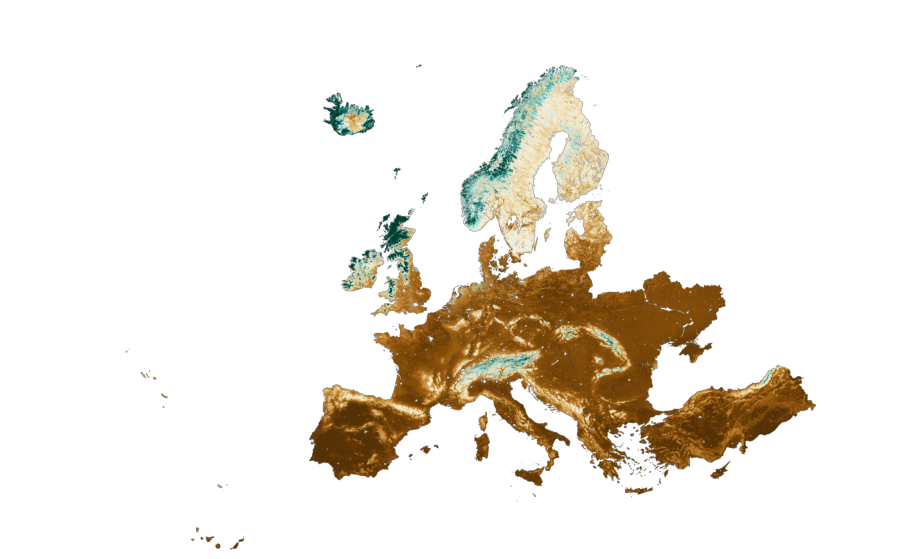
This dataset, part of the Soil Health Data Cube from the AI4SoilHealth project, provides high-resolution, spatiotemporal predictions of Soil Organic Carbon Density (SOCD) across pan-European regions—including the UK, Ukraine, and Turkey—from 2000 to 2022, in 4-year intervals.
Coverage: Pan-Europe, including multiple depth layers (0–20 cm, 20–50 cm, 50–100 cm, 100–200 cm)
Variables:
SOCD (kg/m³) – mean, 2.5th percentile, and 97.5th percentile
Organic carbon content (WPCT %) – based on ISO 10694:1995
Temporal Resolution: 3D+Time (3D spatial + temporal coverage), updated in 4-year intervals
Spatial Resolution: 30m
Format: Cloud Optimized GeoTIFF (COG)
Statistical Method: Machine learning (Quantile Random Forest)
Use Cases: Soil health monitoring, carbon stock analysis, climate mitigation, land management strategies
⚠️ First release for testing purposes only. Dataset is provided “as is”; peer-reviewed publication in progress (PeerJ, under review).