PyLM: A Python Implementation for Landscape Mosaic Analysis

Landscape ecology is the study of how different land uses and natural areas are arranged across a region, and how these spatial patterns affect biodiversity, ecosystem health, and human impacts. […]
Global estimation of post-fire soil erosion

Wildfires affect land surface and post-fire geomorphological activity worldwide, increasing surface runoff and soil erosion. However, a global quantitative assessment considering the cumulative effect of several wildfires is still missing. […]
A data-driven indicator for assessing the evolving impact of the EU CAP on soil erosion mitigation

The data presented here correspond to the updated LAND Use and Management (LANDUM) model, a core component of the European Commission’s RUSLE-based soil erosion risk assessment framework. LANDUM functions as […]
Spatiotemporal prediction of soil organic carbon density (SOCD) for pan-Europe (2000-2022) in 3D+T

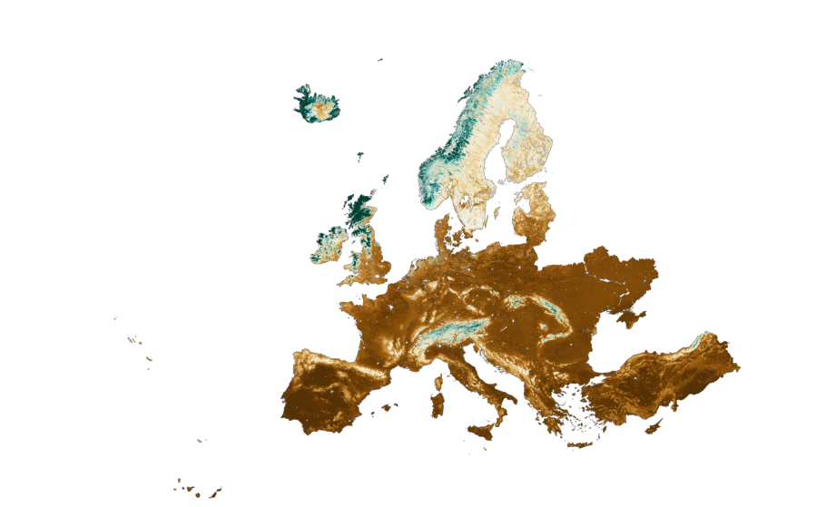
This dataset, part of the Soil Health Data Cube from the AI4SoilHealth project, provides high-resolution, spatiotemporal predictions of Soil Organic Carbon Density (SOCD) across pan-European regions—including the UK, Ukraine, and […]